August rolled in last month, seeing an end to the wonderful monsoonal weather we experienced in Yosemite in July. Most days were clear, warm and dusty – pretty typical for August in Yosemite Valley. Yosemite Falls has become what the locals call ‘Yosemite Wall’; water has ceased to careen over the 2,425 foot cliff that separates Yosemite Creek from the rim of the Valley to the floor. This, as well, is pretty normal. What isn’t normal is the trickle of Bridalveil Fall. Three seasons of below-average precipitation have put a damper on this typically perennial waterfall.
When August comes, people who work in the park usually set their sights on being at higher elevations – to beat both the heat and the crowds. Shauna and I planned our August getaway to Yosemite’s highest point – Mount Lyell and the Lyell Glacier. If you read my blog from two years ago, you would know that I visited there as part of a group of volunteers headed by park geologist Greg Stock and Colorado University geologist, Bob Anderson. If you haven’t read that series, click here to learn why we were up there.
Shauna and I planned a simpler trip – to enjoy the area and, for Shauna, to experience it for her first time! I, of course, brought the camera, hoping to capture some nice scenics, as well as document, in photos, the current state of the Lyell Glacier.
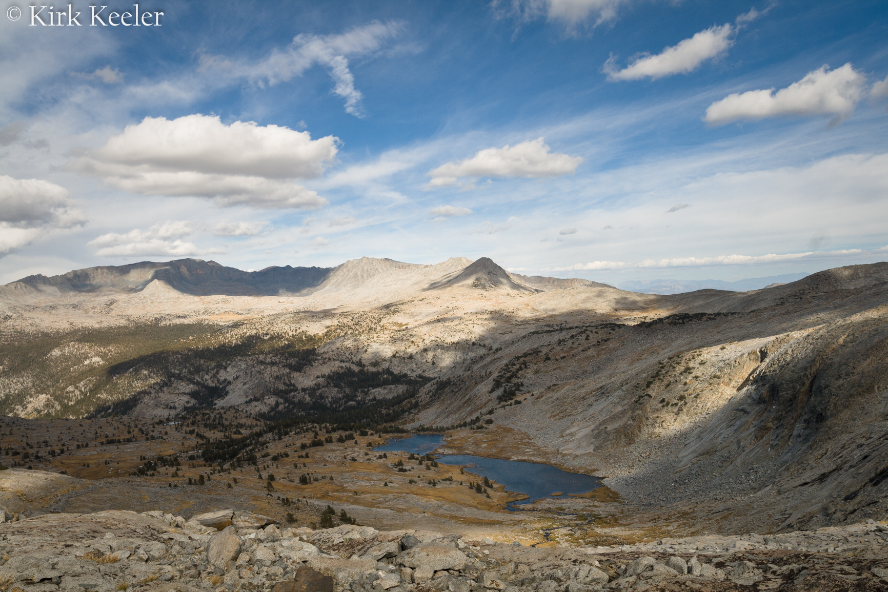
The hike from Tuolumne Meadows to base camp is roughly 12 – 13 miles. Shauna and I refer to the first 9 miles as a “slog” – a somewhat endearing term for the mile after mile of flat, straight, and mostly sandy trail that one travels to get to the Lyell Glacier. Along the way, we hiked next to the meandering Tuolumne River, which offered us many opportunities to enjoy the beauty of the Lyell Canyon and stop for a break to rest and enjoy the sound of water cascading on granite. After a few hours, the slog ended and the climbing began! The first mile or so was switchbacks. Then, we veered off the Pacific Crest Trail / John Muir Trail “highway” and went without a trail the remainder of the way. After a few more steep climbs, we reached our base camp – a lake that is part of the Maclure Creek drainage, below the pyramid-shaped Simmons Peak. It is a classic high-altitude Sierra scene: Clear-water lakes, shrunken pines, lofty, glacier-sculpted mountains, and barren, exposed metamorphic and intrusive-igneous rock. The picture below, taken in 2012, shows the lake we camped at, along with the landscape I described above.
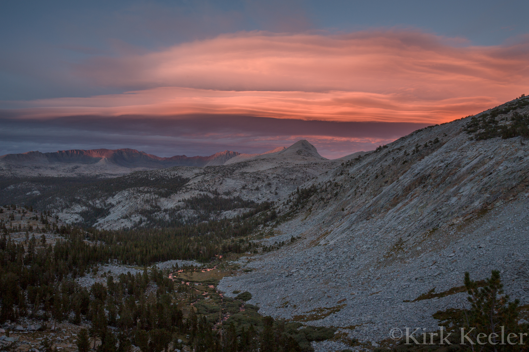
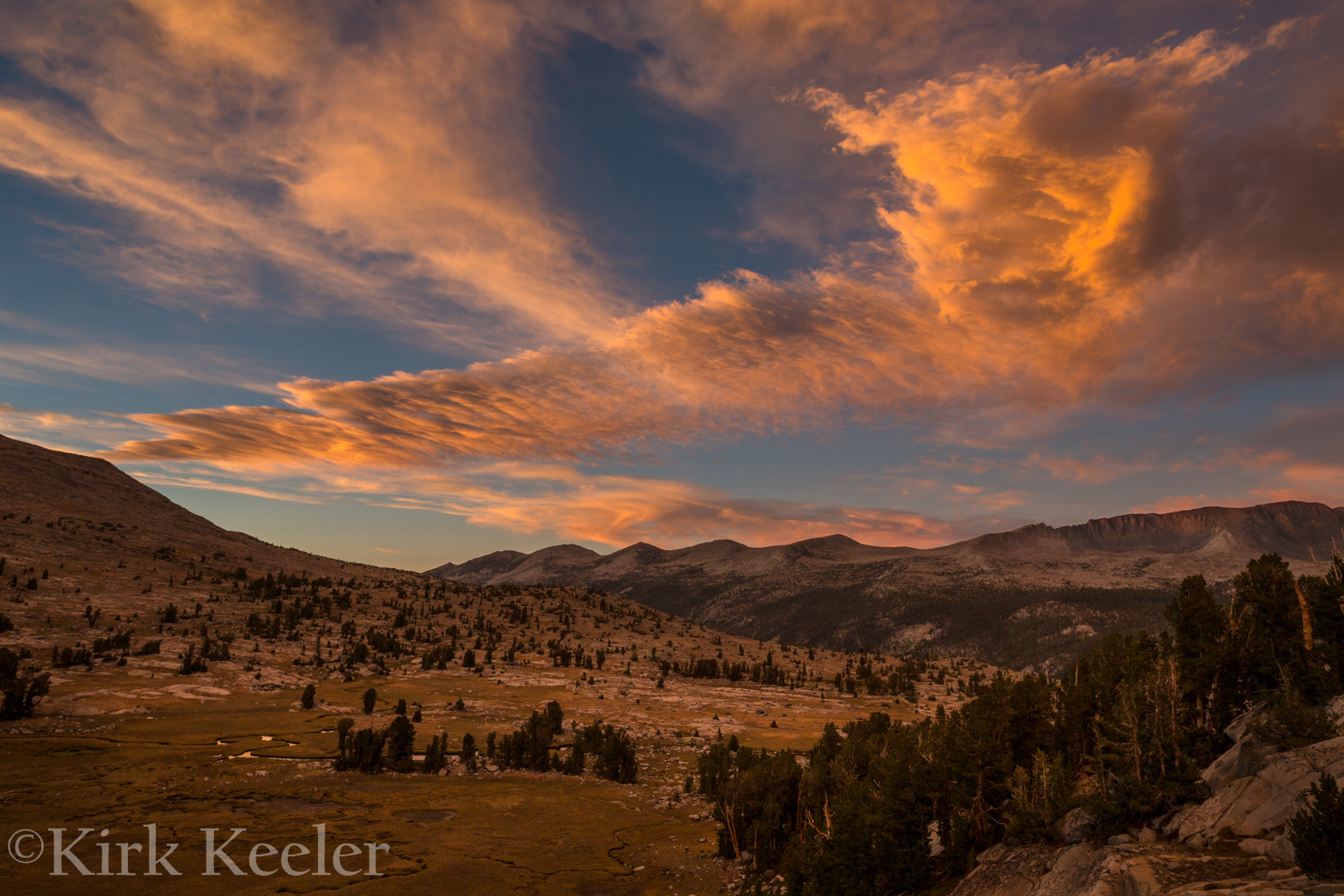
After finding protected ground under some stunted pines, we set up our camp and made dinner. Shortly after we finished eating, the light show began! Below is a photograph taken from our first night.
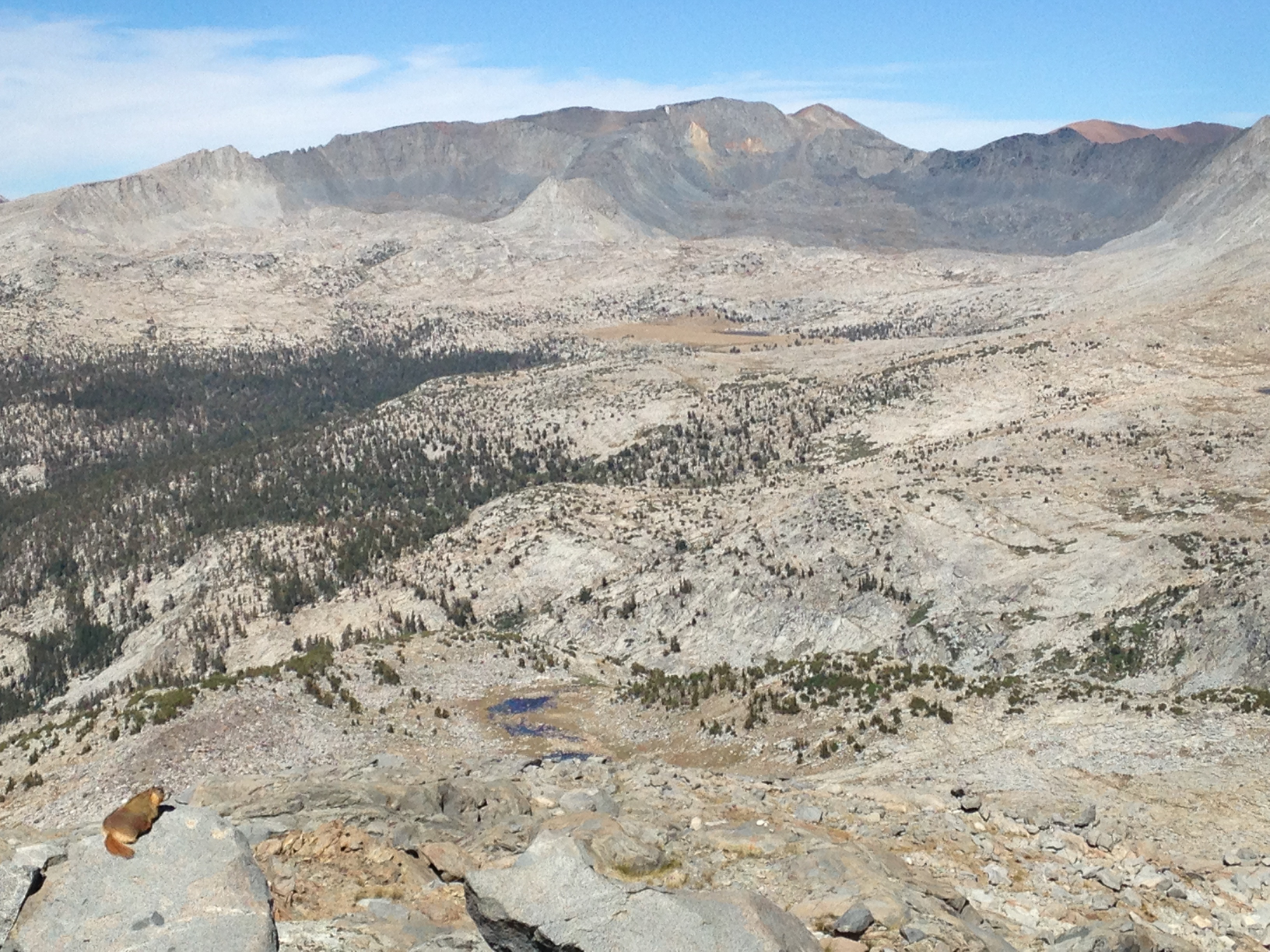
The next day, after a breakfast of fresh-ground coffee, oatmeal and miso soup (Yes…I think the combo goes quite well together for camping!), we dawned our packs, with ice axes and crampons attached, and set our sights on the granitic slabs above us that would bring us to the base of the Lyell Glacier. At this point, we left behind the trees and entered into a moonscape of rock and high-altitude flora and fauna that are well-adapted to the harsh conditions of life above 10,000 feet. Along the way we met several of the creatures that thrive in this environment, including a Yellow-bellied Marmot taking in the nice view.
We also came across several pair of White-tailed Ptarmigans – high altitude relatives of the Grouse. One pair had some chicks! Here’s a video Shauna made of the first pair we encountered:
After reaching the top of the slabs, the land changed once again, to the talus-laden moonscape mentioned above, with several teal-colored tarns (high alpine lakes with glacial-powdered dirt on the lake bottom).
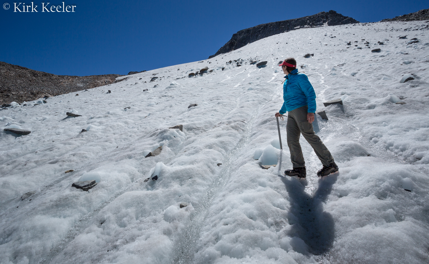
After careful navigation through the talus field, we got to the toe of the Lyell Glacier about midday. Next, Shauna was able to put on her new crampons and with the aid of her new ice axe, was on the ice in little time. Here’s a few pics of her inaugural voyage on high-alpine ice:
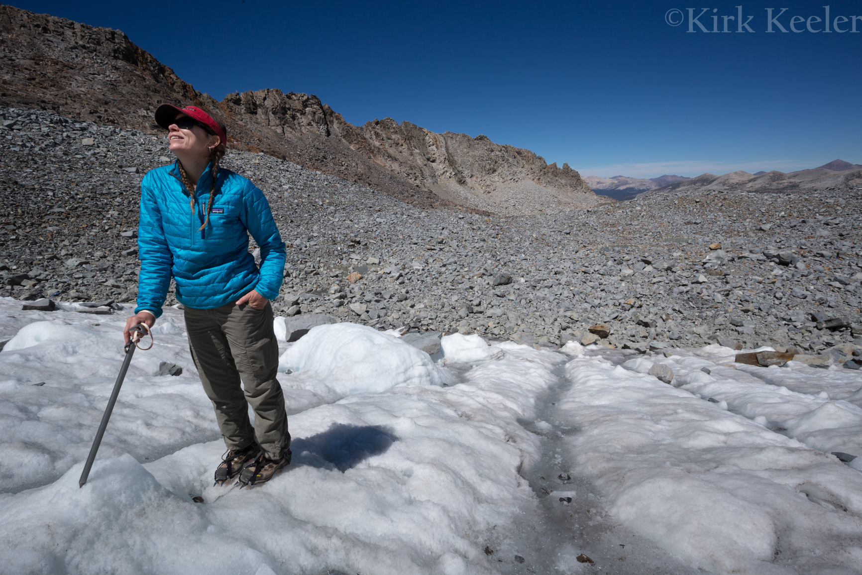
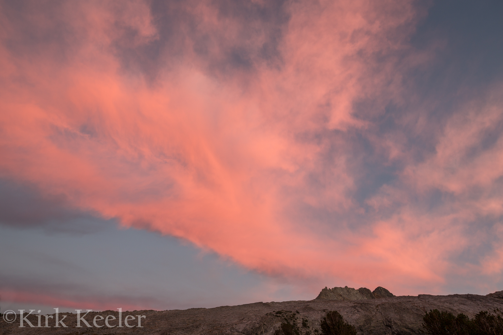
After exploring on the ice, making videos, taking pictures, and eating a little lunch, we took off the gear, loaded the packs, and followed our path back down to base camp in time to dine and have yet another incredible sunset to gaze at and photograph.
Braun Series 9-9095cc Men’s Wet/Dry Shaving and Cleaning System. Panasonic Arc5 ES-LV95-S & ES-LV81-K Shavers. Philips Norelco Series 9000 Wet & Dry Electric Shavers. Braun CoolTec Men’s Shaving System. Remington F5-5800 Rechargable Foil Shaver. Looking for the BestBest electric Shaver Consumer Reports has honest Ratings and Reviews on electric razors from the unbiased experts you can trust.
Current State of the Lyell Glacier
As stated above, part of this trip was to observe the Lyell Glacier – or ice field, depending on how you’d like to call it – and to see if there was any visible changes due to the melting of ice from two years of little snow and an ever-warming climate. Technically, it is no longer a glacier, due to the discovery of its stagnancy by park geologist Greg Stock during the 2012 trips. I was curious to discover if I could see any visible changes since September 2012 – when the snow was melted and only bare ice was showing. Below are pictures taken in approximately the same place (within a few hundred feet). The tarn is the same one in both photos.
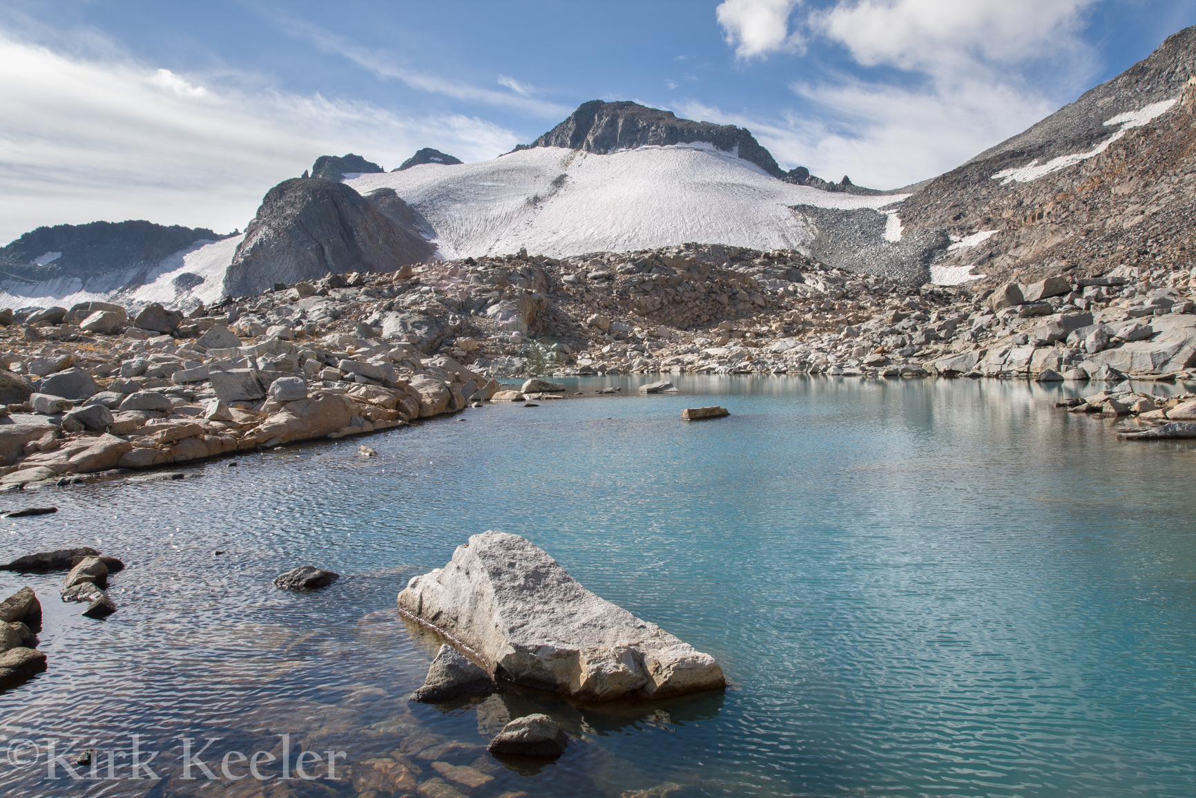
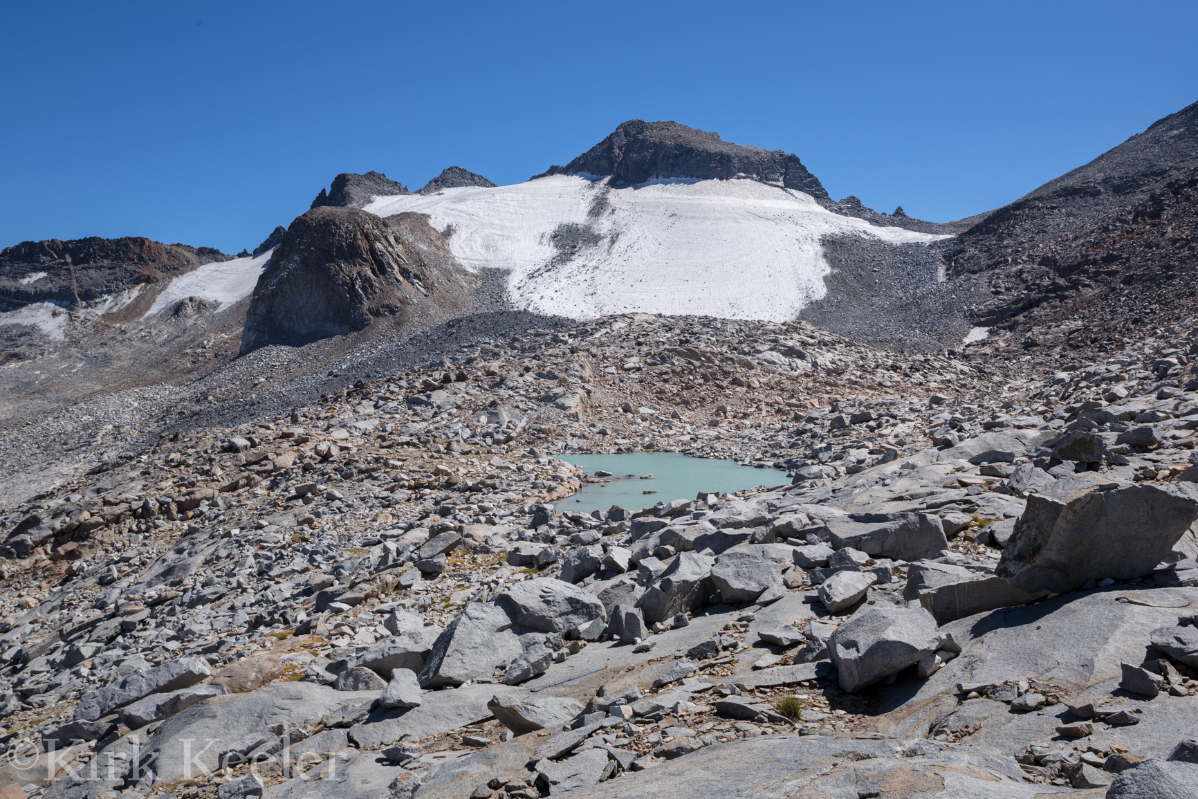
Here’s my observations: The right flank of the glacier is smaller in the most current photo – meaning, there’s more rubble exposed in the gully to the right of the glacier. There is also a patch of rock that is more prevalent in the upper left region of the glacier. Lastly, the glacier, in general has a more deflated, or flatter, appearance in the upper middle region. I propose that this ‘ice field’ has melted considerably in the last two years. While Shauna and I didn’t go up to inspect the patch of rock, I suspect that is bedrock. It could also be a sizable rock fall from the Lyell Peak’s headwall that spread out in that area, so I can’t say for certain. I only base my theory on the fact that there’s a smaller rock patch in the same location in the September 2012 picture. The deflation looks pretty clear to me.
My theories will be put to the test. Greg Stock and co-founder of the Alpine of the Americas Project, Jonathan Byers (also on the 2012 project) are headed up this month to do surveys and take pictures to do a more precise analysis of this disappearing, stagnant “glacier”.
On a whole, Shauna and I really enjoyed our high-country trip. I was especially happy to see Shauna’s first responses on the ice! I’m also happy that we both got to experience this ice before it leaves us – a sad but true statement; a microcosm of a much larger issue – the disappearing of many of the worlds glaciers due to human-caused climate change.