Just a quick update:
Went out to check on things before all the roads closed at 5pm this evening.
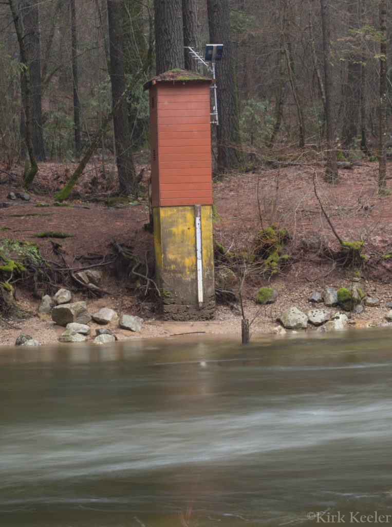
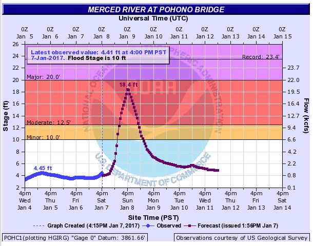
As seen in the photo and water graph for the Merced River above: In the last 24 hours, the river has gone up about .8 feet; so, not much so far. Notice, however that the predicted max. river height has gone up by two feet since this morning’s post. That’s a little disconcerting.
There’s lots of water coming off the cliffs here! Here’s a video I took of Yosemite Falls and what I’ll be calling Castle Cliffs Cascade. I’m not sure if this cascade has a name, but I’ve never seen this much water in it – even during high spring runoff!
Yosemite Falls & Castle Cliffs Cascade, January 7th at 3pm from Kirk Keeler on Vimeo.
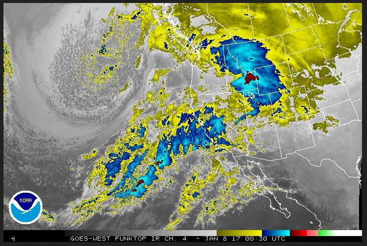
And last, but not least – Here’s what the satellite looked like at 5pm today over California. Wow! That’s a lot of water headed our way:
Unfortunately, I will no longer be able to drive around Yosemite Valley, but will post what pics and videos I can from Yosemite Village.
That’s it for now. I’ll check back in tomorrow morning.
Kirk