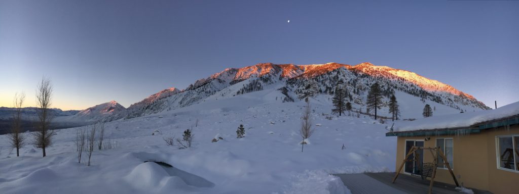
The winter of ‘16/’17 in the Sierra Nevada is shaping up to be quite impressive! I wrote this blog (January 20th) from a house above Bishop, where constant snow was falling – perhaps a few inches an hour at times. Mammoth, just north of here, at the time of this writing, had the most snow for any ski town in the entire West. My friends and I waited out storms, dug out when there was a break, and managed to get some great xc skiing time between the big snow storms.
What A Yosemite Photographer Does in Winter
Winter in Yosemite is a time for slowing down and recuperation from the busy season. That means vacation! My January vacation started with the idea to xc ski at Mammoth for a few days. Then, I threw in a few days at Death Valley – a place I haven’t been to for 27 years and would be a first as a photography trip.
I left Saturday, Jan. 14th in the rain. I decided to just push through and drive all the way to Death Valley and got there about 9pm.
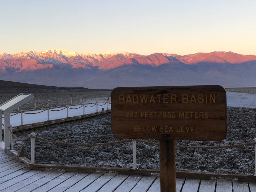
Usually, I plan my photography trips with much detail, but for a few reasons, I didn’t do that for Death Valley. So, when I woke up at pre-dawn the next morning, I made the decision to head down to the spot that this land is most noted for – the lowest point in North America, Badwater, at 282 feet below sea level. I got to Badwater just as the morning sun was beginning to hit Telescope Peak in the Panamint Range to the west.
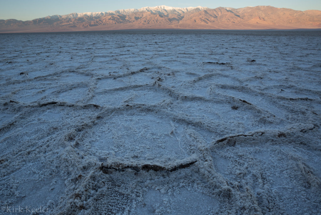
I walked out to the playa and took some photos of the interesting salt features on the ground there.
I was surprised to see a parking lot and established paths at Badwater. When I was there during a college geology trip in 1989 or ’90, none of that infrastructure was there – it was just a pullout on the side of the road with a small sign!
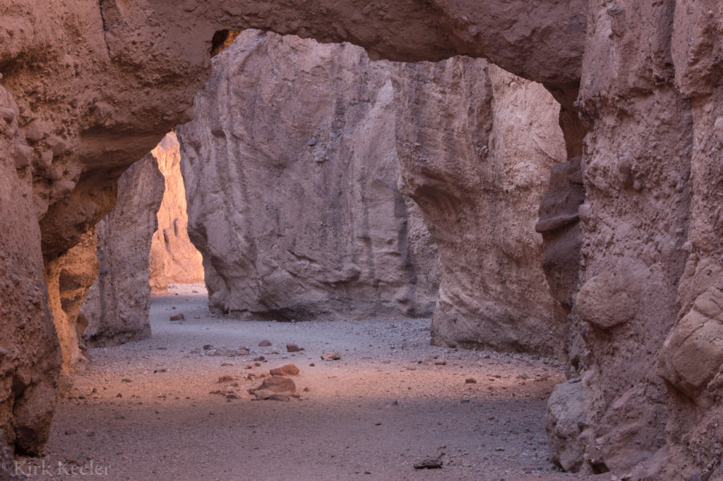
After returning to my car and brewing a cup of coffee, I headed north back towards Furnace Creek. I decided to make a stop at Natural Bridge. I didn’t know this spot existed, so was up for some exploring! Here’s a pic from that hike:
In the Afternoon, I headed up to Zabriski point for a nice afternoon hike.
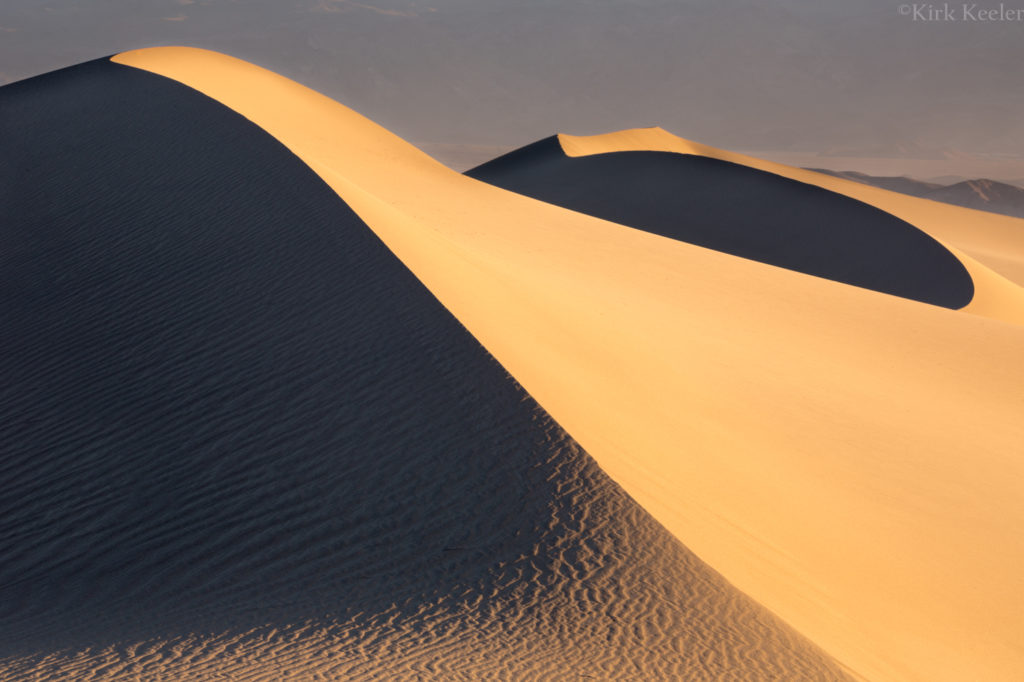
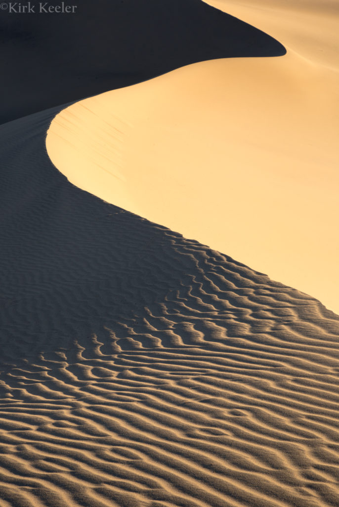
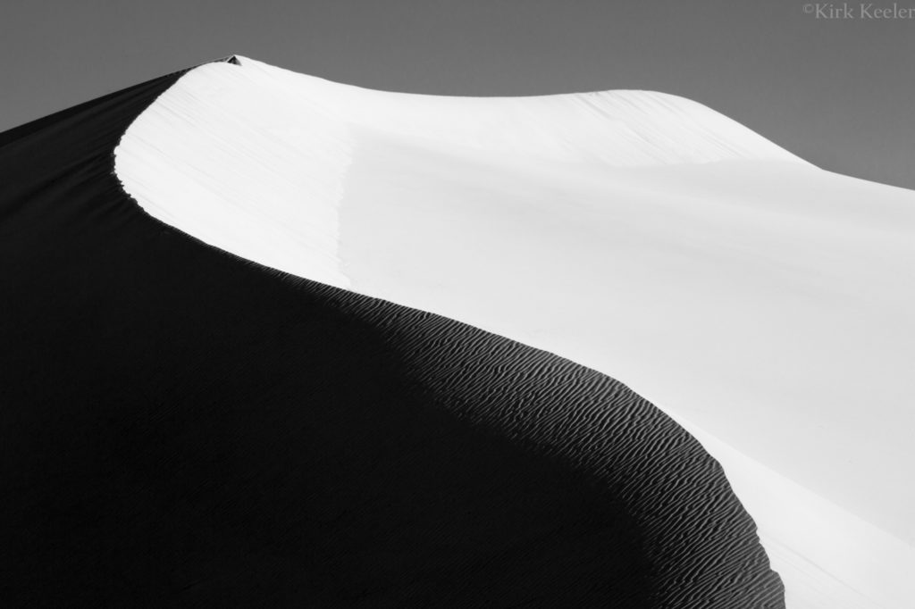
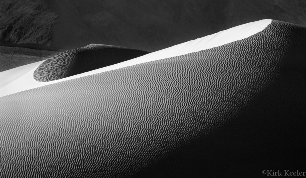
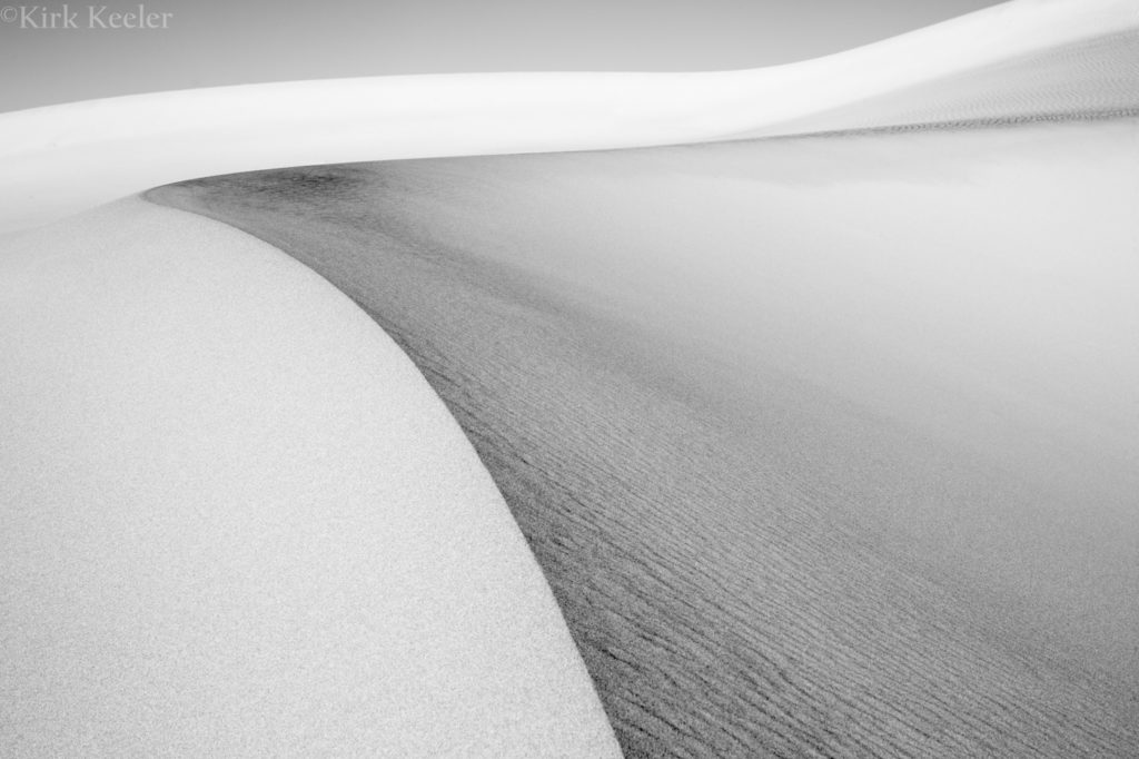
Mesquite Sand Dunes
No doubt, my favorite time in Death Valley was visiting and photographing Mesquite Dunes, near Stovepipe Wells. I woke up early Monday (Jan. 16) morning and drove out to the dunes parking lot. I had done some recon the night before and saw that most of the close dunes, including the tallest ones, were demolished by tourist’s footprints and sand sledding escapades, so opted to walk a fair distance to more remote and untouched sand. I’m glad I did! What I discovered were dunes only touched by the wind. Below are a few of my favorite photos from the session:
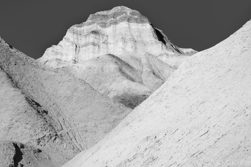
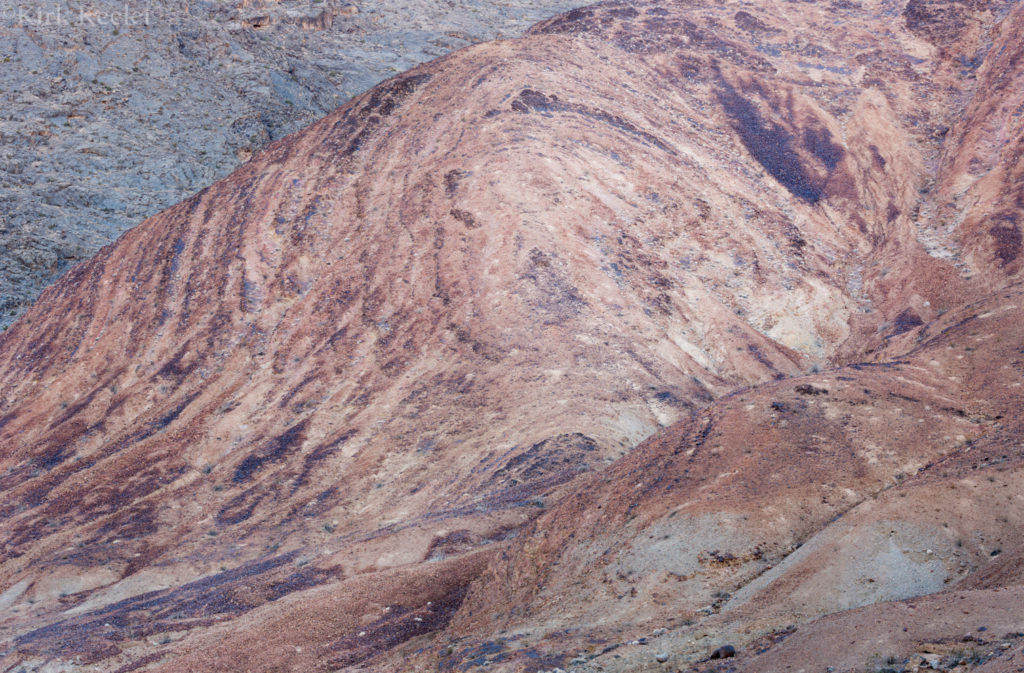
That afternoon was dedicated to going up Marble Canyon, northwest of Stovepipe Wells. Without the planning, the outing felt very adventurous. It ended up being mostly a great hike through a desolate, barren landscape, turning around at a landscape that was inspiring to my more geologic sensitivities:
Phase 2: Bishop CA
After an incredible shower and a fun dinner with ex-Yosemite-now-Death-Valley rangers, I headed north to Bishop to spend time with friends skiing in Mammoth. After two days of incredible skate skiing, I awoke to over a foot of snow on Thursday (Jan. 19), so spent most of the day helping to dig out the house I stayed at, as well as the buried cars. I spent some moments with the camera to photograph the surrounding landscape:
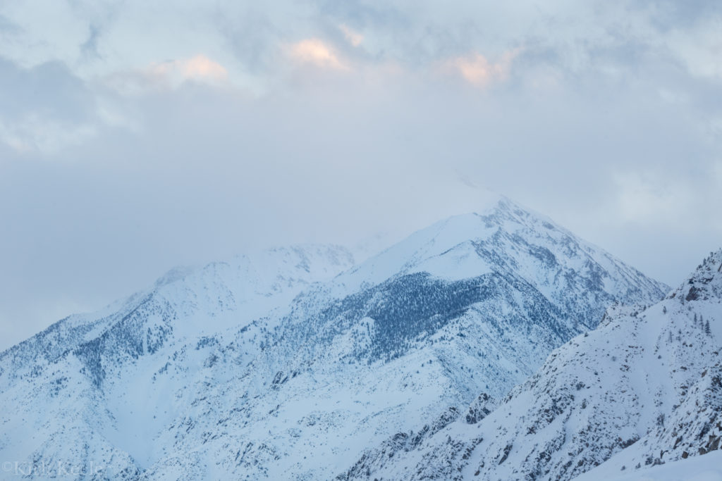
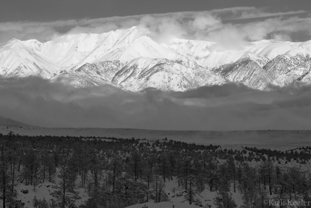
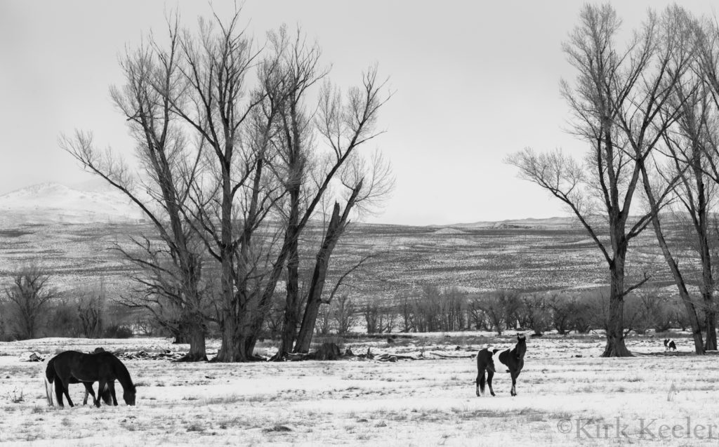
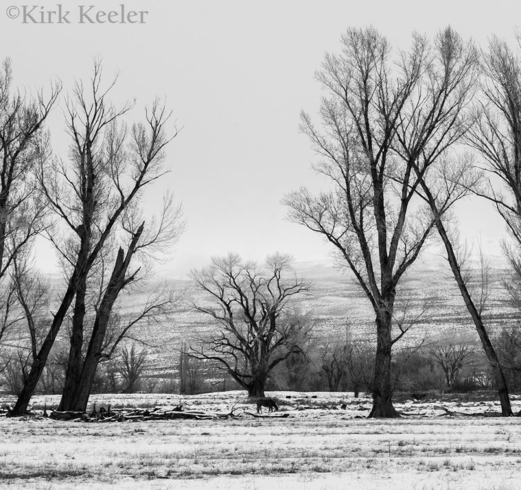
The area surrounding Bishop CA reminded me so much of the Nepali Himalaya! Truly inspiring landscape!!
As I finished wrapping up this blog post, I glanced up to look outside. It was snowing pretty hard! I’d be back outside to start shoveling snow again. Perhaps that might sound displeasing, but I kinda looked forward to it. Yah…I know…CRAZY!!